Published on
January 12, 2026
Share on

.png)
If you wandered into a local government office a century ago, you’d see clerks elbow-deep in paper files, planners sketching zoning maps by hand, and inspectors clutching clipboards like life preservers. Today that same office runs on cloud systems, GIS dashboards, real-time sensors, and digital workflows.
One thing hasn’t changed, though: every new tool came with at least one person who wanted it taken back. From the early mainframes to modern AI, local governments have not only evolved technologically — they’ve learned to adapt, adjust, and occasionally grumble their way into the future.
Here’s the story of that journey.
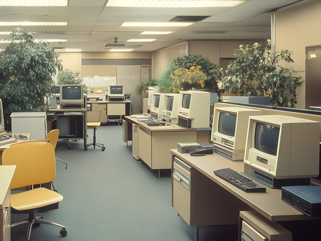
For decades, even centuries, local governments ran entirely on paper. Permits lived in metal filing cabinets. Council agendas were typed by hand. Planners used massive wall maps, rulers, and pure artistic talent to draw zoning boundaries.
Many were perfectly happy with that, as paper didn’t crash, paper didn’t need a software update, and paper didn’t require your nephew to explain how to use it. But paper was slow, fragile, and hard to share, but innovation was coming whether staff were ready or not.
The digital age arrived with mainframe computers and the birth of Geographic Information Systems (GIS). Roger Tomlinson, often called the father of GIS, pioneered systems capable of storing geographic data digitally. (BCS : History of GIS) By 1979, governments were experimenting with platforms like MOSS (Map Overlay and Statistical System). (MicroImages :MOSS)
Reactions varied:
Learning curves were steep, training was intense, and many planners still kept a pencil tucked behind their ear “just in case.” But the seeds of the digital revolution had been planted.
By the 1980s, GIS had matured, with cities using it for land-use planning, emergency management, utilities, and public works. The Canada Land Inventory (CLI), became a well-known example of how a basic GIS system could grow into enterprise-wide infrastructure. (Canada Land Inventory)
This era also saw the first big push toward digitizing paper archives. Governments scanned records, built electronic databases, and embraced shared digital filing.
Naturally, this sparked new concerns:
ICMA notes that digital records dramatically improved searchability and collaboration. (ICMA : Digital Transformation) Still, many staff kept a secret paper backup “just to be safe.”
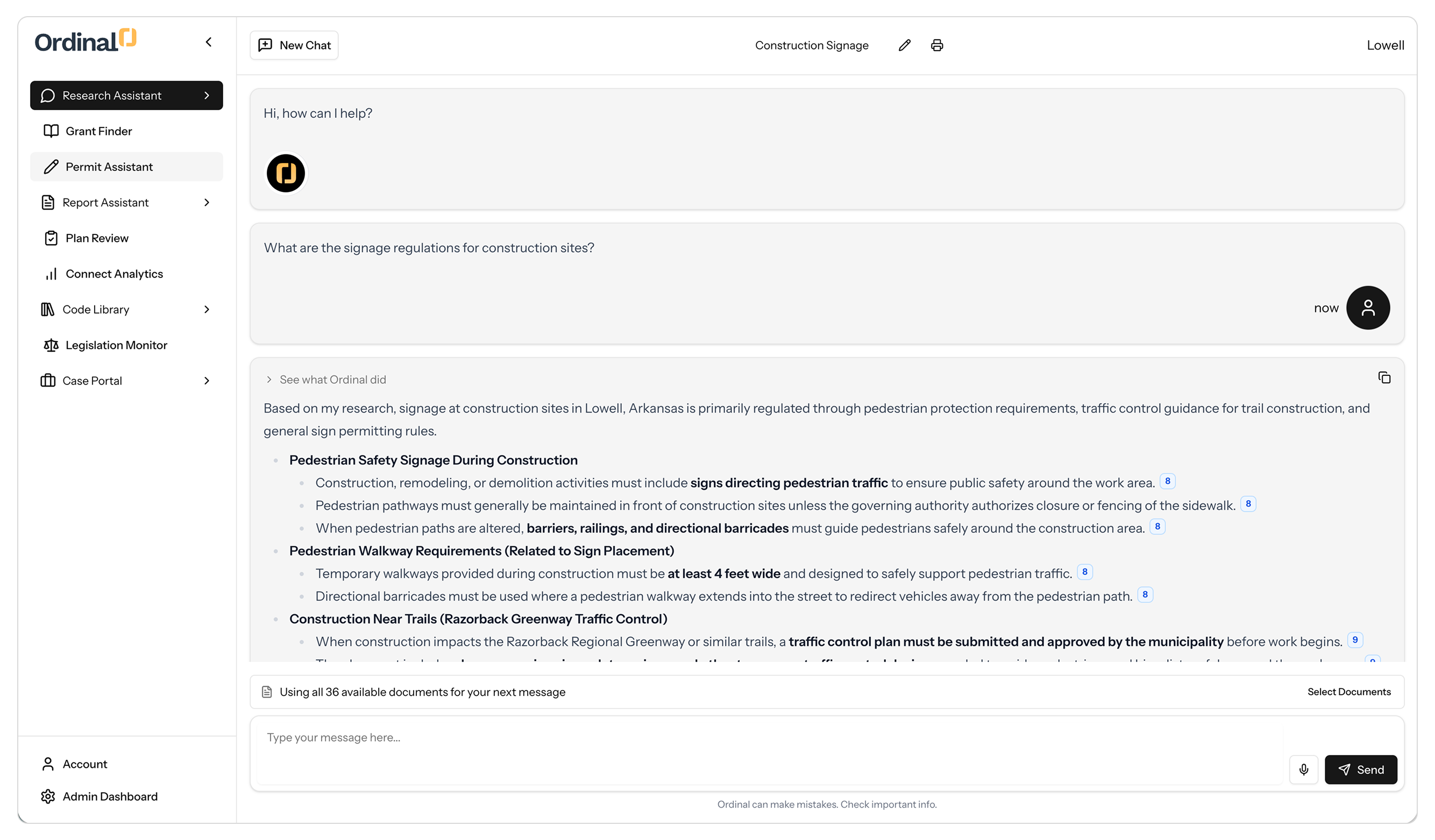
Once the Internet took hold, everything changed. Cloud systems allowed multiple departments to share the same records in real time.
E-government tools exploded onto the scene for government at all levels. The following list features just a few of the items that every member of local government has probably discussed more than a few times:
Initially, some staff doubted residents would ever trust the Internet for government services. “Why would someone apply online when they could get the permit in person like they’ve always done?” But, seeing the potential to save time and avoid the often-dreaded government office lobby, many residents embraced it immediately. Academic research shows us that e-government significantly improves accessibility and efficiency, both of which are major priorities in the modern era of development. (MDPI: E-Government Transformation)
At the same time, GIS became cheaper and more accessible. Even small jurisdictions launched interactive public maps. (GovTech: Evolution of GIS) Transparency soared, engagement increased, and steadily, skepticism began to fade.
Modern local government embraces smart technologies that benefit communities:
Esri describes today’s landscape as a fully integrated “smart community” environment (Esri: Smart Communities Evolution), but there was hesitation here, too:
Yet, as soon as staff saw how quickly problems could be identified and fixed, the skepticism began to fade away. Citizen engagement tools expanded as well, giving residents new ways to submit ideas, report issues, and participate digitally. (arXiv: Digital Citizen Engagement Platforms)
Tomorrow’s tools may include:
And yes — these changes may also spark hesitation. That’s normal. If history shows anything, it’s this: Local government professionals are incredibly good at learning new tools, even when they’re not sure they want to.
This evolution matters because governments can make better decisions via the GIS, data dashboards, and analytics (helping governments plan ahead instead of reacting after the fact). We get faster services, by way of the digital permitting and cloud workflows saving hours of staff time. More transparency, with public-facing data building trust and clarifying decisions. Greater equity, with the availability of online access allowing residents to engage without needing to show up in person. Better resilience, as real-time data helps governments respond to emergencies faster and more effectively. Last, but certainly not least…We’ve learned to grow with technology that felt intimidating at first, but would ultimately improve how governments serve communities.
It is my hope that the contents of this article will spur on conversations that will continue the growth and appreciation for evolution of the tools and resources available to make government work for and with the people it is meant to serve. Thank you to all of the public servants out there who devote their time to making this happen.


Ready to see Ordinal in action? Book some time with our team and we’ll show you just how valuable this could be for you and your staff.

We create innovative solutions that simplify complexities and empower success for communities everywhere.
Copyright 2025 - BreakGround Technologies